I went archery hunting November 10,11, and 12 at game lands 80 on Blue Mountain. I had my treestand in the area where I saw a large buck back in October. I did not see that big buck again.
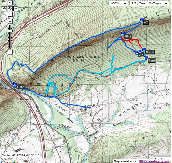
The dark blue path is my track of 11/10/09.
The light blue path is my track of 11/11/09.
The red path is my track of 11/12/09.
Stand. lat="40.486447318" lon="-76.487963134" - Where my treestand was located all three days. Saw no deer while up in it.
x. lat="40.485986816" lon="-76.489260066" - Where I discovered that someone else had a treestand.
y. lat="40.485786069" lon="-76.490169754" - Where I discovered that someone else had a treestand.
Pic1. lat="40.490100570" lon="-76.494235899" - After cutting my way through lots of briars, I discovered this old road or trail. It led up to the AT on the top of the mountain. Photo
AT. lat="40.493305894" lon="-76.488545258" - Where the path I found meets the Appalachian Trail. Photo
Gate. lat="40.478509739" lon="-76.526768832" - Game Lands access gate.