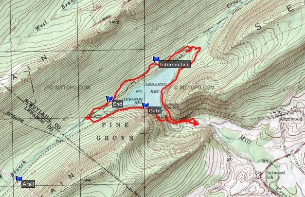
I set off to walk the entire perimeter of the Lebanon Reservoir. Parked off Old Forge Road. Followed the trail at the east end of the dam. I discovered a cable that allows for an easy crossing of Fishing Creek. The north side of the lake is very rocky and I didn't find a trail until I reached the point on the map labeled "Intersection." At the intersection I headed west but could have gone east. The eastern trail can be explored some time. The trail died out, but I managed to find my way around the western end of the lake and up onto the rail-trail.
creek
reservoir
reservoir
dam
dam
plaque
The entire walk covered 4.3 miles.