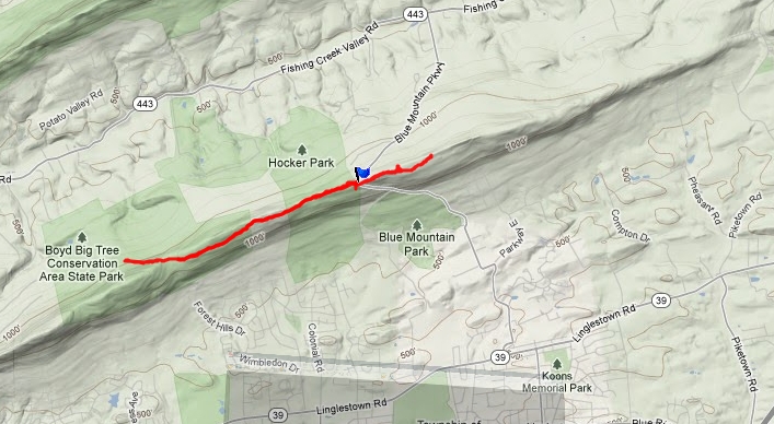
I parked at the top of Blue Mountain (blue flag on map) in the Hocker Park parking area along Blue Mountain Parkway. First I headed east along what I think used to be part of the Darlington Trail. View from the top of the mountain. There was a tower on the top of the mountain with a warning sign. I wanted to see if the trail would lead all the way over to Piketown Road. The trail soon ran into private property. I walked through the private land until the trail disappeared. I headed back to the car and then continued west on a red blazed trail that lead into the Boyd Big Tree Conservation Area. I passed a sign for the Coach Trail and turned around when I reached a sign for the Janie Trail. The hike covered 5.92 miles.