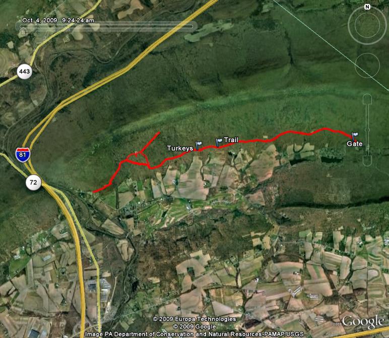
Started at the Game Lands 80 parking area just off of Old State Road. Took the northern trail east until it dead-ended. I then took the southern trail east until I came to the gate and parking area along Monroe Valley Drive. The total hike was 5.6 miles according to the GPS.
Turkeys. Lat. 40°29'2.84"N; Long. 76°29'16.48"W. Where I saw at least a half-dozen turkeys.
Trail. Lat. 40°29'4.89"N; Long. 76°28'57.99"W. Where a trail heads up the mountain.
Gate. Lat. 40°29'9.18"N; Long. 76°26'55.04"W.Where I stopped and turned around.