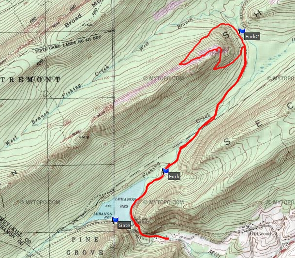
Parked my car at the gate at the end of Old Forge Road. Hiked past Swatara furnace and the Christian Siegrist dam. I followed the trail through the woods east of the dam. I followed the trail/road until it reached the top of Sharp mountain. I stayed on the road (old mining road) as it headed back down and intersected with the original trail/road. There were other mining roads at the top of the mountain that can be explored some other day. I witnessed crop falls at the top of the mountain. Crop falls are where the mountain has basically caved-in where coal had been extracted beneath many years ago. The next time I come out here I want to cross the creek and explore the north side of the reservoir.
View of Lebanon reservoir, me at Fishing Creek just east of the reservoir, Fishing Creek.
The entire hike covered just over 7 miles.