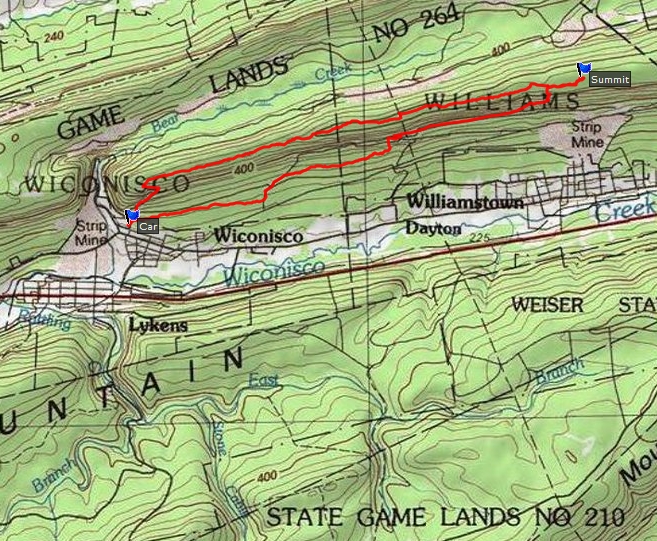
My objective was to reach the highest point in Dauphin County, Pennsylvania. The high point is located within state game lands number 264. I parked in a Game Commission parking area just off of Pottsville Road north of Lykens. I started hiking about 9:00 am. There was an old road leading to the top of the mountain where a tower was standing. Beyond the tower there is no road or trail leading across the top of the mountain. It was a long, uninteresting, and rocky hike across the mountaintop. I took photos when I crossed the powerline cut (north, south.) About a half mile from the summit there was what I assume to be an old mining road. The summit area offered no good views - just an overgrown mountaintop. I reached the summit at 12:19. Took the mining road back down and followed it as long as I could - it died out just west of the powerline. It was a grueling 9.95 mile hike. The rocky trailless terrain was rough on the feet and legs. Got back to the car at 3:10 pm.
Photos: vulture, northern view