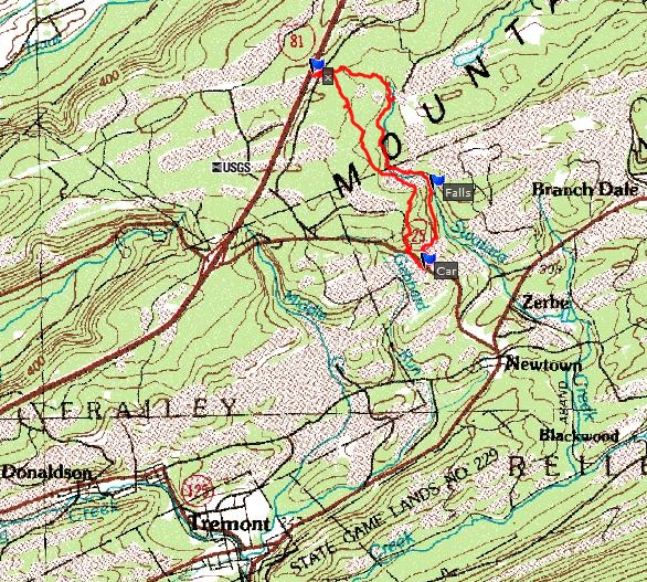
I parked at the same place that I did two weeks ago when visiting Swatara Falls. I followed the same trail to the falls. I then set out to follow the creek upstream to its source. About a hundred yards above the falls is a smaller waterfall (5 or 6 feet high.) The stream flowed under two mining company bridges. The creek eventually turned in a more westerly direction and crossed open land that has apparently been timbered to open it for mining. I followed the creek until it came trickling out of a drain pipe under Interstate 81. I took a more direct route back to the car, passing a nearby mine. It was a 5.6 mile round trip hike.